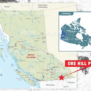
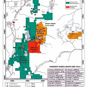
The Ore hill Gold-Silver Property is located 15 kilometres east of the historic mining town of Salmo.in southern British Columbia, Canada. The 2,000-hectare, road accessible property is situated at the south end of the 10 km long Sheep Creek Gold Camp with historical gold production of almost 800,000 ounces at an average gold grade of 14.4 g/t. The Sheep Creek camp is an orogenic gold district similar to the Barkerville Gold Camp located 600 km to the north.
Veins in the Sheep Creek Gold Camp are high-grade, steeply dipping, sub-parallel, low-sulfide quartz veins. Individual veins averaged approximately 1 m in width and were mined over strike lengths of up to 550 m and up to 500 m depths. Vein widths tended to increase with depth while gold grades decreased with depth.
The Ore Hill property covers the historically known Ore Hill and Summit gold mines that were initially staked in 1901. The veins have been explored with nine adits with over 1,200 metres of underground development. Between 1906 and 1940, a total of 3,335 tonnes of ore were mined and 115,671 grams of gold, 202,307 grams of silver, 93,985 kilograms of lead and 88,639 kilograms of zinc were recovered (BC Minfile 82FSW054 & 082FSW053).
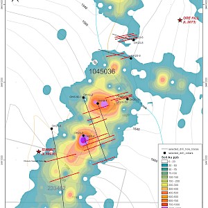
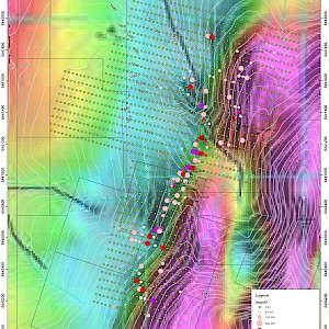
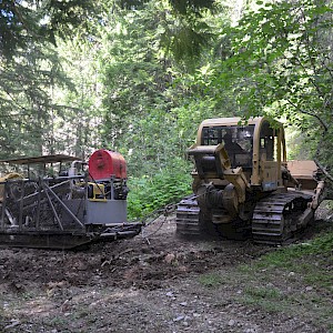
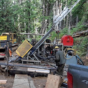
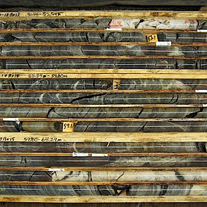
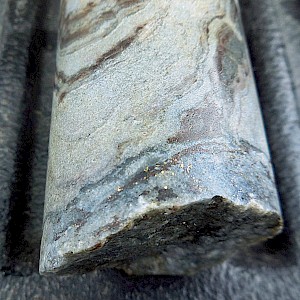
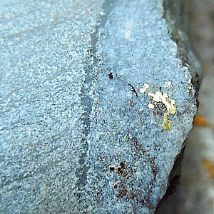
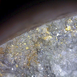
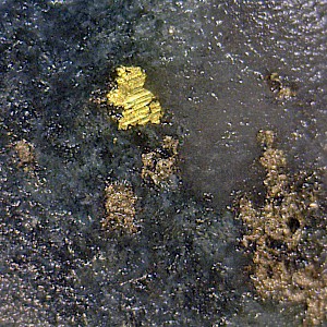
In 2019-2020 Apex Resources explored the property with 2,000 metres of diamond drilling in 12 NQ holes. The drill program is testing a 1,500 metre-long, gold in soil anomaly that extends across the property. To date 12 drill holes have been completed from 7 drill stations along a 500-metre-long section of the soil anomaly. Many of the holes intersected multiple zones of gold mineralization associated with a sheeted quartz vein system. Forty-seven significant gold intersections were obtained from 11 of the drill holes. Thirty-five of the intersections assayed greater than 1.0 g/t with thirteen of the intersections exceeding 5.0 g/t gold. Two styles of mineralization are seen: veins containing only native gold and veins carrying gold values with associated silver lead and zinc values
Highlights of the drilling are as follows:
OH19-1: 2.02 g/t Au over 5.90 metres
OH19-1: 289.97 g/t Au over 0.30 metres
OH19-2: 6.93 g /t Au over 0.85 metres
OH20-4: 2.76 g /t Au over 4.63 metres
OH20-4: 11.02 g /t Au over 1.06 metres
OH20-5: 3.17 g/t Au over 2.00 metres
OH20-5: 8.34 g/t Au over 0.41 metres
OH20-7: 7.10 g/t Au over 1.11 metres
OH20-8: 5.40 g/t Au over 0.67 metres
OH20-8: 35.40 g/t Au over 0.31 metres
OH20-8: 4.73 g/t Au over 2.00 metres
OH20-9: 5.27 g/t Au over 1.59 metres
OH20-10: 2.11 g/t Au over 1.41 metres
OH20-10: 3.21 g/t Au over 0.89 metres
OH20-12: 1.63 g/t Au over 2.00 metres
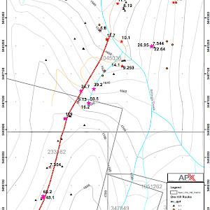
In the current program drill stations are situated at 50 to 80 metre intervals along the soil anomaly. Drilling has now successfully tested a 500-metre-long section of the soil anomaly located between the historic Summit Mine to the south and the historic Ore Hill Mine to the north. The favorable drill results have demonstrated that soil geochemistry and surface rock sampling are excellent tools for tracing mineralization on the Ore Hill property.
The historic mine workings of the Sheep Creek Mine located immediately north of the Ore Hill property found that the gold veins increase in width at depth. In the Sheep Creek Mine the most productive sections of the veins occurred between 400 metres and 850 metres below the elevation of Ore Hill (BCGS Bulletin 31). If the situation is similar at Ore Hill, there is a potential vertical extent of roughly 850 metres for the veins with vein width increasing with depth.
Deep drilling is recommended in order to investigate the depth continuity of the Ore Hill veins.

